2015 Map of The Reefs
USGS Topo · Published 2015About this map
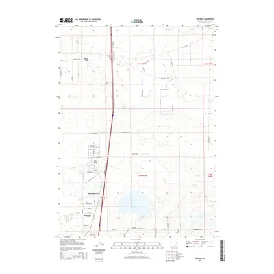
Bar Nunn and its unique residential street layout, built upon the former runways of a historic airfield, anchor the central portion of this Natrona County landscape. The map reveals a suburban-industrial corridor north of Casper characterized by residential developments such as Homa Hills, Richardson Acres, and Hartrandt positioned near the regional transport spine of the Salt Creek Highway. The terrain is defined by the namesake geological formation The Reefs to the west and the expansive depressions of Ninemile Lake and Soda Lake to the south. This survey captures the area's transition from open rangeland to a structured grid of rural-residential roads with evocative names like Bucking Horse Blvd and Belt Buckle Blvd, illustrating the modern development patterns of the Wyoming high plains near Evansville and Harford Field.
Find a feature on this map
69 named features on this map. Tap any name to fly to it.
Don’t see what you’re looking for? This feature index may not catch every label — zoom into the map to look around manually.
Map Details
Editions of this 2015 The Reefs Map
This is the sole edition of this map. No revisions or reprints were ever made.
Other maps of this area

1949 · Brookhurst
USGS Topo · 1:24,000

1949 · Pratts Soda Lakes
USGS Topo · 1:24,000

1950 · Brookhurst
USGS Topo · 1:24,000

1950 · Pratts Soda Lakes
USGS Topo · 1:24,000

1950 · Goose Egg
USGS Topo · 1:24,000

1951 · The Reefs
USGS Topo · 1:24,000

1951 · Casper
USGS Topo · 1:24,000

1952 · Bishop
USGS Topo · 1:24,000

1955 · Arminto
USGS Topo · 1:250,000

1955 · Casper
USGS Topo · 1:250,000