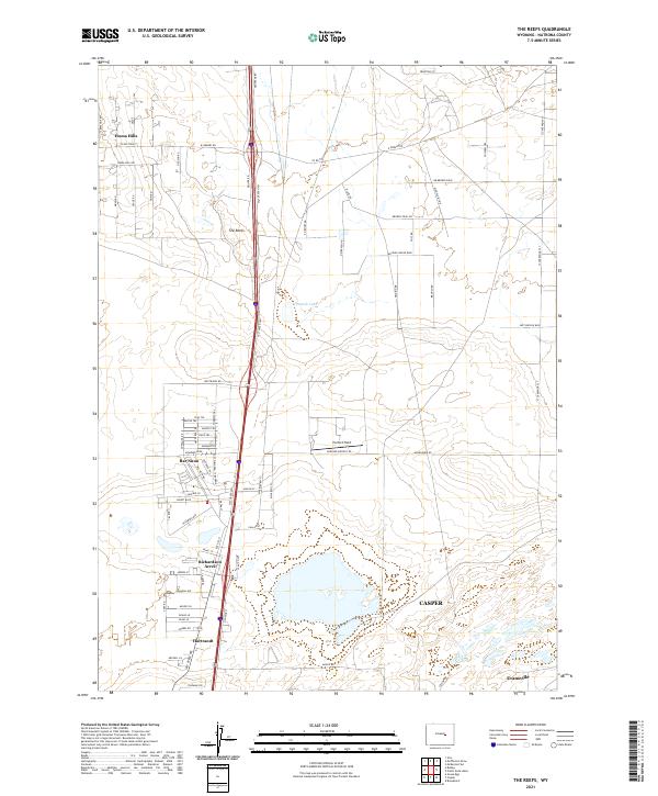
2021 Map of The Reefs
USGS Topo · Published 2021About this map
Salt Creek Hwy serves as the primary north-south spine for this Wyoming landscape, dividing the suburban expansion of northern Casper from the open rangeland and drainage basins to the east. The map captures a transition from organized residential tracts like Bar Nunn and Richardson Acres to more sparsely settled areas near The Reefs. This 2021 survey highlights the intersection of modern aviation and local infrastructure, specifically at Harford Field and the surrounding street network. To the north, Homa Hills sits above the basin of Ninemile Lake, where the terrain is marked by a grid of named roads such as W Ormsby Rd and Bucking Horse Blvd. The map also preserves traces of older routes, including a segment labeled Abandoned Rd, offering a contrast between the developing outskirts of Evansville and the enduring cattle-country heritage of Natrona County.
Find a feature on this map
80 named features on this map. Tap any name to fly to it.
Don’t see what you’re looking for? This feature index may not catch every label — zoom into the map to look around manually.
Map Details
Editions of this 2021 The Reefs Map
This is the sole edition of this map. No revisions or reprints were ever made.
Other maps of this area

1949 · Brookhurst
USGS Topo · 1:24,000

1949 · Pratts Soda Lakes
USGS Topo · 1:24,000

1950 · Brookhurst
USGS Topo · 1:24,000

1950 · Pratts Soda Lakes
USGS Topo · 1:24,000

1950 · Goose Egg
USGS Topo · 1:24,000

1951 · The Reefs
USGS Topo · 1:24,000

1951 · Casper
USGS Topo · 1:24,000

1952 · Bishop
USGS Topo · 1:24,000

1955 · Arminto
USGS Topo · 1:250,000

1955 · Casper
USGS Topo · 1:250,000