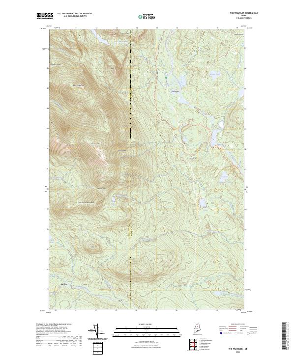
2024 Map of The Traveler
USGS Topo · Published 2024About this map
The Katahdin Woods and Waters National Monument dominates this northern Maine landscape, where the East Branch Penobscot River carves a winding path through the wilderness. This modern survey illustrates the complex topography of the Traveler Range, centered on the high peak of The Traveler and its neighbors, North Traveler Mtn and South Traveler Mtn. The river's course is marked by traditional water features like The Oxbow, Stair Falls, and several distinct pitches such as Haskell Rock Pitch and Pond Pitch.
Find a feature on this map
38 named features on this map. Tap any name to fly to it.
Don’t see what you’re looking for? This feature index may not catch every label — zoom into the map to look around manually.
Map Details
Editions of this 2024 The Traveler Map
This is the sole edition of this map. No revisions or reprints were ever made.
Other maps of this area

1927 · Katahdin
USGS Topo · 1:48,000

1930 · Katahdin
USGS Topo · 1:62,500

1949 · Katahdin
USGS Topo · 1:62,500

1953 · Stacyville
USGS Topo · 1:62,500

1954 · Shin Pond
USGS Topo · 1:62,500

1954 · Presque Isle
USGS Topo · 1:250,000

1954 · Millinocket
USGS Topo · 1:250,000

1955 · Traveler Mountain
USGS Topo · 1:62,500

1958 · Presque Isle
USGS Topo · 1:250,000

1958 · Millinocket
USGS Topo · 1:250,000