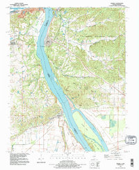
2024 Map of Thebes
USGS Topo · Published 2024About this map
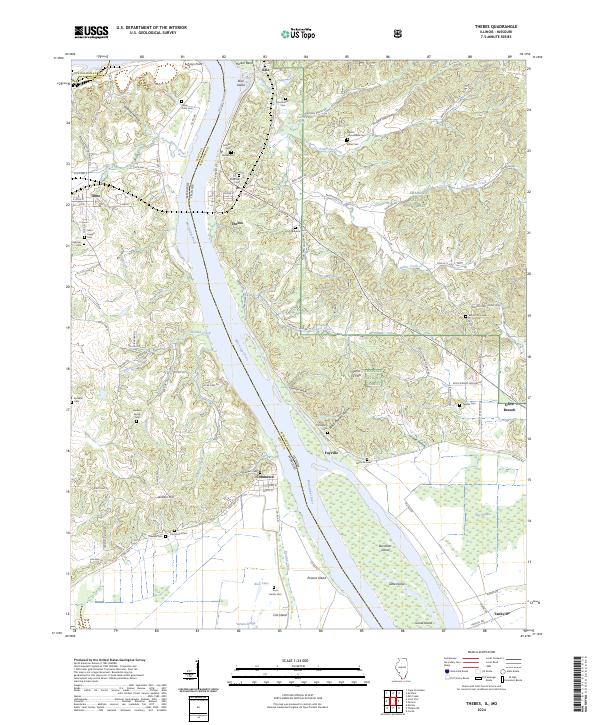
The Mississippi River creates a sweeping boundary between Missouri and Illinois on this modern survey, where the river's path is marked by features like Hacker Bend and the Doolan Chute. Near the village of Thebes, the landscape shifts from the river bottomlands toward the high ground of the Shawnee National Forest. This area is dense with family history, documented through numerous burial sites such as Rose Hill Cem, Bracken Cem, and the Sanders Family Cem. Settlement patterns follow the topography, with Fayville and Commerce situated along the riverbanks, while the eastern portion of the map is defined by deep hollows like Jones Hollow and Black Powder Hollow. Further south, the river environment opens into a network of islands and sloughs, including Powers Island, Cat Island, and the wetlands of Big Cypress, reflecting the complex hydrology of the central river valley.
Find a feature on this map
104 named features on this map. Tap any name to fly to it.
Don’t see what you’re looking for? This feature index may not catch every label — zoom into the map to look around manually.
Map Details
Editions of this 2024 Thebes Map
This is the sole edition of this map. No revisions or reprints were ever made.
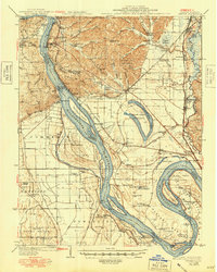
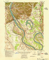
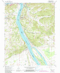
Historical Maps of Scott County Through Time
7 maps found