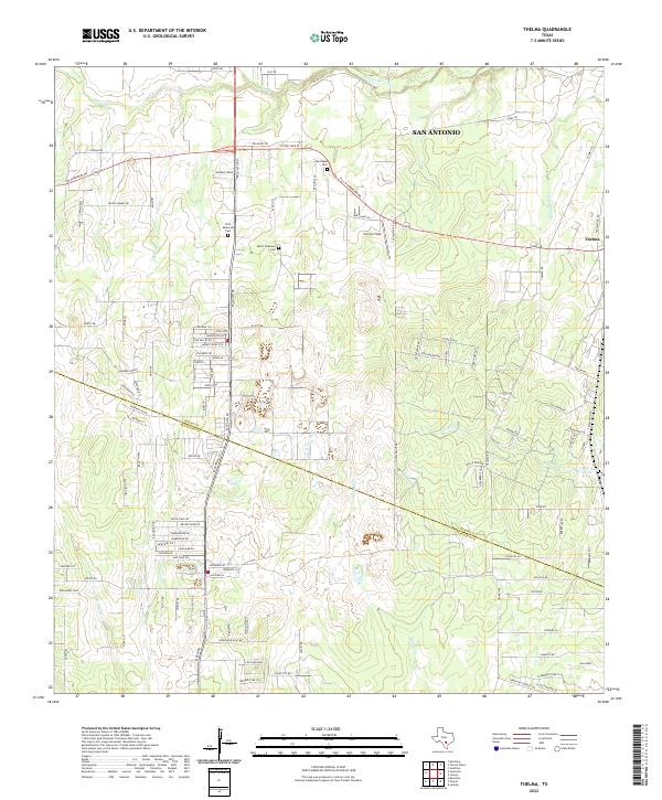
2022 Map of Thelma
USGS Topo · Published 2022About this map
The southern edge of San Antonio meets the rural reaches of the Bexar and Atascosa county line in this survey of the South Texas brush country. The landscape is defined by the dendritic drainage of several vital watercourses, including the Medina River and its tributaries like Elm Creek, Palo Alto Creek, and Gallinas Creek. Settlement patterns are concentrated along historic thoroughfares such as Palo Alto Road and Pleasanton Road, which lead toward the small community of Thelma.
Find a feature on this map
110 named features on this map. Tap any name to fly to it.
Don’t see what you’re looking for? This feature index may not catch every label — zoom into the map to look around manually.
Map Details
Editions of this 2022 Thelma Map
This is the sole edition of this map. No revisions or reprints were ever made.
Other maps of this area

1953 · Terrell Wells
USGS Topo · 1:24,000

1953 · Macdona
USGS Topo · 1:24,000

1953 · Southton
USGS Topo · 1:24,000

1954 · San Antonio
USGS Topo · 1:250,000

1957 · San Antonio
USGS Topo · 1:250,000

1958 · Losoya
USGS Topo · 1:24,000

1958 · Somerset
USGS Topo · 1:24,000

1958 · Thelma
USGS Topo · 1:24,000

1964 · Leming
USGS Topo · 1:24,000
1967 · Terrell Wells
USGS Topo · 1:24,000