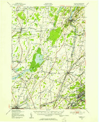
1948 Map of Theresa
USGS Topo · Published 1953About this map
Pine Camp Military Reservation dominates the southeastern quadrant of this Jefferson County landscape, a significant footprint in the years following World War II. The terrain is defined by the convergence of several waterways, including the Indian River and the Chaumont River, where numerous small settlements like Theresa, La Fargeville, and Evans Mills serve as local hubs. These communities are linked by the New York Central railroad, which cuts through the region alongside older thoroughfares like Military Road and Silver Street.
Find a feature on this map
89 named features on this map. Tap any name to fly to it.
Don’t see what you’re looking for? This feature index may not catch every label — zoom into the map to look around manually.
Map Details
Editions of this 1948 Theresa Map
This is the sole edition of this map. No revisions or reprints were ever made.
Other maps of this area

1893 · Sackets Harbor
USGS Topo · 1:62,500

1895 · Sacketts Harbor
USGS Topo · 1:62,500

1895 · Watertown
USGS Topo · 1:62,500

1898 · Watertown
USGS Topo · 1:62,500

1900 · Clayton
USGS Topo · 1:62,500

1902 · Carthage
USGS Topo · 1:62,500

1903 · Grindstone
USGS Topo · 1:62,500

1903 · Clayton
USGS Topo · 1:62,500

1903 · Alexandria Bay
USGS Topo · 1:62,500

1903 · Theresa
USGS Topo · 1:62,500