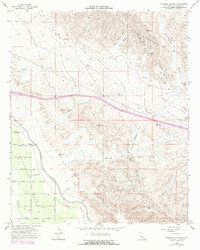
1956 Map of Thermal Canyon
USGS Topo · Published 1973About this map
The Coachella Valley unfolds as a study in water management and desert transition during the mid-1950s. The vital path of the Coachella Canal and its associated Wasteway No 2 demonstrate the engineering required to sustain this arid landscape. To the north and east, the elevation rises sharply into the Little San Bernardino Mts and the complex terrain of the Mecca Hills, where the eponymous Thermal Canyon and Double Canyon cut through the desert floor. This edition, updated in the early 1970s, captures the grid-like development of agricultural access roads including Avenue 52 and Pierce Street, which sit in contrast to the natural topography of landmarks like Mesa Hill and Front Hill.
Find a feature on this map
23 named features on this map. Tap any name to fly to it.
Don’t see what you’re looking for? This feature index may not catch every label — zoom into the map to look around manually.
Map Details
Editions of this 1956 Thermal Canyon Map
4 editions found
Other maps of this area

1904 · Indio
USGS Topo · 1:125,000

1940 · Cottonwood Spring
USGS Topo · 1:62,500

1941 · Coachella
USGS Topo · 1:62,500

1943 · Coachella
USGS Topo · 1:62,500

1943 · Pinkham Well
USGS Topo · 1:62,500

1944 · Cottonwood Spring
USGS Topo · 1:62,500

1944 · Pinkham Well
USGS Topo · 1:62,500

1944 · Pinyon Well
USGS Topo · 1:62,500

1947 · Santa Ana
USGS Topo · 1:250,000

1949 · Santa Ana
USGS Topo · 1:250,000