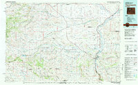
1981 Map of Thermopolis
USGS Topo · Published 1982About this map
The Bighorn River and Wind River define the thermal and industrial character of this central Wyoming region during the early 1980s. At the heart of the map, Thermopolis and East Thermopolis sit adjacent to Hot Springs State Park, a site long-famed for its geothermal activity. The geography is marked by the sharp transition from the Owl Creek Mountains and the northern reaches of the Wind River Indian Reservation to the resource-rich basins. The map documents an active energy landscape, highlighting the Maverick Spring Dome Oil Field and the Burlington Northern railroad corridor, which served the coal and agricultural interests of the valley. Smaller outposts like Gebo, Embar, and Hamilton Dome reveal the distribution of ranching and mining communities that established the local economy.
Find a feature on this map
124 named features on this map. Tap any name to fly to it.
Don’t see what you’re looking for? This feature index may not catch every label — zoom into the map to look around manually.
Map Details
Editions of this 1981 Thermopolis Map
This is the sole edition of this map. No revisions or reprints were ever made.
Other maps of this area

1904 · Kirwin
USGS Topo · 1:125,000

1906 · Kirwin
USGS Topo · 1:125,000

1911 · Meeteetse
USGS Topo · 1:62,500

1913 · Meeteetse
USGS Topo · 1:62,500

1913 · Grass Creek Basin
USGS Topo · 1:62,500

1914 · Blue Mesa
USGS Topo · 1:62,500

1915 · Grass Creek Basin
USGS Topo · 1:62,500

1916 · Blue Mesa
USGS Topo · 1:62,500

1945 · Kirby
USGS Topo · 1:62,500

1946 · Kirby
USGS Topo · 1:62,500