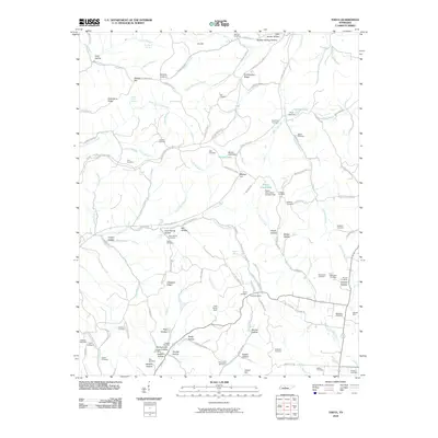
2010 Map of Theta
USGS Topo · Published 2010About this map
Chestnut Ridge and the winding course of the Natchez Trace Pkwy define this part of Maury County, where the landscape is carved by numerous hollows and springs. The area is dense with family and community burial grounds, including the Theta Cemetery, Gaskill Cemetery, and Pennywinkle Cemetery, providing a significant record of local genealogy. Water management is a visible priority here, seen in features like McCall Lake, Poplar Grove Lake, and the Lost Acres Dam. In the southeast, the Hatcher Mine sits near Carters Creek, reflecting a pocket of industrial activity amidst the rural terrain. The mapping of Cave Springs and Yellow Rock Spring highlights the importance of natural water sources in this ridge-and-hollow geography.
Find a feature on this map
127 named features on this map. Tap any name to fly to it.
Don’t see what you’re looking for? This feature index may not catch every label — zoom into the map to look around manually.
Map Details
Editions of this 2010 Theta Map
This is the sole edition of this map. No revisions or reprints were ever made.
Other maps of this area

1901 · Colombia
USGS Topo · 1:125,000

1909 · Franklin
USGS Topo · 1:62,500

1936 · Godwin
USGS Topo · 1:24,000

1936 · Williamsport
USGS Topo · 1:24,000

1936 · Primm
USGS Topo · 1:24,000

1936 · Spring Hill
USGS Topo · 1:24,000

1936 · Theta
USGS Topo · 1:24,000

1936 · Carters Creek
USGS Topo · 1:24,000

1936 · Craigfield
USGS Topo · 1:24,000

1940 · Godwin
USGS Topo · 1:24,000