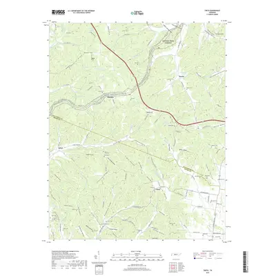
2019 Map of Theta
USGS Topo · Published 2019About this map
Cunningham Ridge and Greenbrier Ridge dominate this section of the Tennessee countryside where the border of Williamson and Maury counties weaves through the hills. This modern survey illustrates the persistent rural character of the area, anchored by historical routes like the Natchez Trace Parkway and the Natchez Trace National Scenic Trail. Small settlements including Theta, Boston, and Smarden serve as focal points for a landscape dotted with numerous family cemeteries such as Andrews Cem, Garrison Cem, and Carlisle Cem, which offer significant value for genealogical research.
Find a feature on this map
149 named features on this map. Tap any name to fly to it.
Don’t see what you’re looking for? This feature index may not catch every label — zoom into the map to look around manually.
Map Details
Editions of this 2019 Theta Map
This is the sole edition of this map. No revisions or reprints were ever made.
Other maps of this area

1901 · Colombia
USGS Topo · 1:125,000

1909 · Franklin
USGS Topo · 1:62,500

1936 · Godwin
USGS Topo · 1:24,000

1936 · Williamsport
USGS Topo · 1:24,000

1936 · Primm
USGS Topo · 1:24,000

1936 · Spring Hill
USGS Topo · 1:24,000

1936 · Theta
USGS Topo · 1:24,000

1936 · Carters Creek
USGS Topo · 1:24,000

1936 · Craigfield
USGS Topo · 1:24,000

1940 · Godwin
USGS Topo · 1:24,000