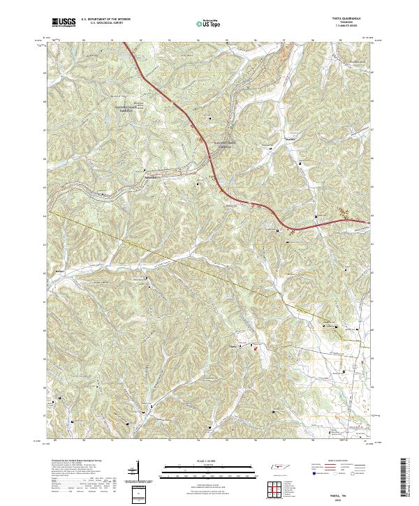
2022 Map of Theta
USGS Topo · Published 2022About this map
The Tennessee Valley Divide snakes across this landscape where Williamson Co meets Maury Co, defining a complex network of ridges and hollows. The Natchez Trace Parkway follows the high ground of Cunningham Ridge and Greenbrier Ridge, mirroring the ancient travel corridor that has long crossed this region. Local settlements like Smarden, Bethel, Boston, and Theta are established along the valley floors and higher clearings, connected by a web of rural routes including Leipers Creek Rd and Bending Chestnut Rd. Numerous family and community burial sites, such as Carlisle Cem, Garrison Cem, and Sparkman Cem, are found near these crossroads. The area's topography is marked by named features like Mobley Cut and Dark Hollow, indicating the persistent influence of the terrain on the road networks and farmsteads found throughout the upper reaches of Leipers Fork and Garrison Cr.
Find a feature on this map
140 named features on this map. Tap any name to fly to it.
Don’t see what you’re looking for? This feature index may not catch every label — zoom into the map to look around manually.
Map Details
Editions of this 2022 Theta Map
This is the sole edition of this map. No revisions or reprints were ever made.
Other maps of this area

1901 · Colombia
USGS Topo · 1:125,000

1909 · Franklin
USGS Topo · 1:62,500

1936 · Godwin
USGS Topo · 1:24,000

1936 · Williamsport
USGS Topo · 1:24,000

1936 · Primm
USGS Topo · 1:24,000

1936 · Spring Hill
USGS Topo · 1:24,000

1936 · Theta
USGS Topo · 1:24,000

1936 · Carters Creek
USGS Topo · 1:24,000

1936 · Craigfield
USGS Topo · 1:24,000

1940 · Godwin
USGS Topo · 1:24,000