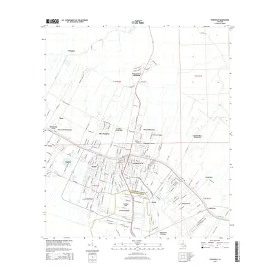
2015 Map of Thibodaux
USGS Topo · Published 2015About this map
Bayou Lafourche anchors the landscape of this contemporary topographic study, cutting through the heart of Thibodaux and defining the orientation of the surrounding settlements. The map illustrates a transition between urban density and the historical plantation system that shaped the region. Several named sites like Abby Plantation, Rienzi Plantation, and Laurel Valley Plantation remain as distinct landmarks on the periphery of the town. This modern record details the expansion of residential developments such as Johnson Ridge, Acadian Villa, and Greenwood Acres, while also showing the institutional presence of Nicholls State Univ and Louisiana Technical College-Lafourche Campus. Genealogists may find value in the location of Saint Johns Cem near the town center and the smaller settlements of Naquin and Choupique that dot the outliers of the Lafourche Parish line.
Find a feature on this map
200 named features on this map. Tap any name to fly to it.
Don’t see what you’re looking for? This feature index may not catch every label — zoom into the map to look around manually.
Map Details
Editions of this 2015 Thibodaux Map
This is the sole edition of this map. No revisions or reprints were ever made.
Other maps of this area

1892 · Lac Des Allemands
USGS Topo · 1:62,500

1892 · Gibson
USGS Topo · 1:62,500

1892 · Houma
USGS Topo · 1:62,500

1892 · Thibodaux
USGS Topo · 1:62,500

1897 · Gibson
USGS Topo · 1:62,500

1927 · Thibodaux NW
USGS Topo · 1:31,680

1932 · Lac Des Allemands NW
USGS Topo · 1:31,680

1932 · Lac Des Allemands SW
USGS Topo · 1:31,680

1932 · Thibodaux NE
USGS Topo · 1:31,680

1932 · Houma NW
USGS Topo · 1:31,680