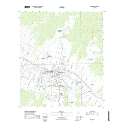
2018 Map of Thibodaux
USGS Topo · Published 2018About this map
Thibodaux serves as the focal point of this 2018 survey, positioned along the banks of Bayou Lafourche. The landscape is a complex intersection of historic sugar production and modern expansion, evidenced by the clustered names of legacy estates like Orange Grove Plantation, Rienzi Plantation, and Abby Plantation that ring the city center. This area is characterized by the "long-lot" or arpent land division system typical of French colonial settlement, where properties like Coulon Plantation stretch away from the bayou to ensure water access.
Find a feature on this map
195 named features on this map. Tap any name to fly to it.
Don’t see what you’re looking for? This feature index may not catch every label — zoom into the map to look around manually.
Map Details
Editions of this 2018 Thibodaux Map
This is the sole edition of this map. No revisions or reprints were ever made.
Other maps of this area

1892 · Lac Des Allemands
USGS Topo · 1:62,500

1892 · Gibson
USGS Topo · 1:62,500

1892 · Houma
USGS Topo · 1:62,500

1892 · Thibodaux
USGS Topo · 1:62,500

1897 · Gibson
USGS Topo · 1:62,500

1927 · Thibodaux NW
USGS Topo · 1:31,680

1932 · Lac Des Allemands NW
USGS Topo · 1:31,680

1932 · Lac Des Allemands SW
USGS Topo · 1:31,680

1932 · Thibodaux NE
USGS Topo · 1:31,680

1932 · Houma NW
USGS Topo · 1:31,680