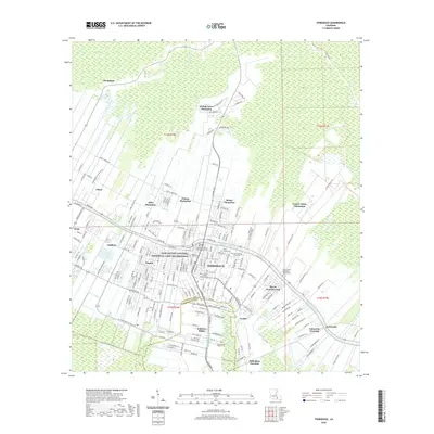
2020 Map of Thibodaux
USGS Topo · Published 2020About this map
Bayou Lafourche bisects this landscape, serving as the central axis for the historic city of Thibodaux and its surrounding agricultural reaches. The map documents a classic South Louisiana settlement pattern where large holdings like Laurel Valley Plantation, Rienzi Plantation, and Abby Plantation extend back from the bayou's natural levees into the low-lying wetlands of Devil Swamp. This 2020 record illustrates the modern academic and civic footprint of the area, anchored by Nicholls State University and the Lafourche Parish Courthouse Annex.
Find a feature on this map
197 named features on this map. Tap any name to fly to it.
Don’t see what you’re looking for? This feature index may not catch every label — zoom into the map to look around manually.
Map Details
Editions of this 2020 Thibodaux Map
This is the sole edition of this map. No revisions or reprints were ever made.
Other maps of this area

1892 · Lac Des Allemands
USGS Topo · 1:62,500

1892 · Gibson
USGS Topo · 1:62,500

1892 · Houma
USGS Topo · 1:62,500

1892 · Thibodaux
USGS Topo · 1:62,500

1897 · Gibson
USGS Topo · 1:62,500

1927 · Thibodaux NW
USGS Topo · 1:31,680

1932 · Lac Des Allemands NW
USGS Topo · 1:31,680

1932 · Lac Des Allemands SW
USGS Topo · 1:31,680

1932 · Thibodaux NE
USGS Topo · 1:31,680

1932 · Houma NW
USGS Topo · 1:31,680