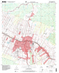
1998 Map of Thibodaux
USGS Topo · Published 2000About this map
Bayou Lafourche serves as the central artery for this late-20th-century landscape, where the historical footprint of the Louisiana plantation system remains clearly visible. Large agricultural holdings such as Laurel Valley Plantation, Rienzi Plantation, and Abby Plantation dominate the outskirts of the growing city of Thibodaux. The map documents a complex transition from sugar production to institutional and residential land use, evidenced by the presence of Francis T Nicholls State University and several modern Mobile Home Park developments. The northern reaches of the quadrangle are marked by the Bayou Onion and an extensive network of artificial waterways, including the Pipeline Canal. This 1998 survey, which includes landmark buildings verified in 1961, also highlights the industrial character of the region through the Chacahola Oil and Gas Field and various pumping stations.
Find a feature on this map
45 named features on this map. Tap any name to fly to it.
Don’t see what you’re looking for? This feature index may not catch every label — zoom into the map to look around manually.
Map Details
Editions of this 1998 Thibodaux Map
This is the sole edition of this map. No revisions or reprints were ever made.
Other maps of this area

1892 · Lac Des Allemands
USGS Topo · 1:62,500

1892 · Gibson
USGS Topo · 1:62,500

1892 · Houma
USGS Topo · 1:62,500

1892 · Thibodaux
USGS Topo · 1:62,500

1897 · Gibson
USGS Topo · 1:62,500

1927 · Thibodaux NW
USGS Topo · 1:31,680

1932 · Lac Des Allemands NW
USGS Topo · 1:31,680

1932 · Lac Des Allemands SW
USGS Topo · 1:31,680

1932 · Thibodaux NE
USGS Topo · 1:31,680

1932 · Houma NW
USGS Topo · 1:31,680