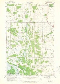
1967 Map of Thief Lake NE
USGS Topo · Published 1969About this map
Stafford, Grimstad, and Enerson townships define the surveyor's grid in this portion of Roseau County during the late 1960s. The landscape is characterized by a patchwork of wooded areas and open fields, often delineated by the fine red dashed lines of fences and field boundaries captured from 1966 aerial photography. In the northeast corner, the Roseau River meanders through the terrain, while the community of Stafford and its namesake Stafford Ch serve as local landmarks. The presence of Oak Hill Cem and Palmville Ch near the southern boundary, specifically in the vicinity of Poplar Grove, highlights the rural community centers established in this region. This survey also records several locations of a Gravel Pit, indicating the local extraction of glacial materials necessary for road maintenance and regional development in the Red River Valley hinterlands.
Find a feature on this map
12 named features on this map. Tap any name to fly to it.
Don’t see what you’re looking for? This feature index may not catch every label — zoom into the map to look around manually.
Map Details
Editions of this 1967 Thief Lake NE Map
2 editions found
Other maps of this area

1918 · Goos
USGS Topo · 1:62,500

1918 · Pencer
USGS Topo · 1:62,500

1918 · Roseau
USGS Topo · 1:62,500

1918 · Garland
USGS Topo · 1:62,500

1943 · Goos
USGS Topo · 1:62,500

1954 · Roseau
USGS Topo · 1:250,000

1957 · Roseau
USGS Topo · 1:250,000

1958 · Roseau
USGS Topo · 1:250,000
1966 · Fox
USGS Topo · 1:24,000

1966 · Malung
USGS Topo · 1:24,000