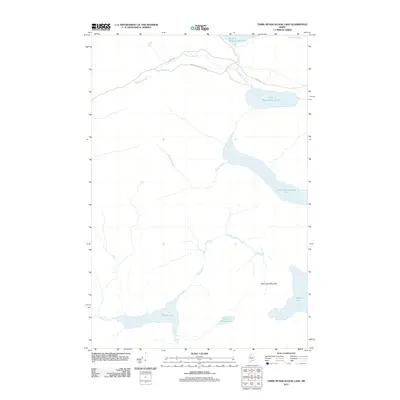
2011 Map of Third Musquacook Lake
USGS Topo · Published 2011About this map
Third Musquacook Lake and its interconnected waterways dominate this remote Maine landscape in the northern Maine woods. The area's character is defined by a series of large glacial lakes, including Fourth Musquacook Lake, Harrow Lake, and Clear Lake, all linked by a network of drainage systems like Musquacook Stream and Bog Brook. The presence of the American Realty Tote Rd and Realty Rd in the northern portion of the map indicates the significance of the timber industry and historical logging transport in this unorganized territory. These roads represent the primary infrastructure in a terrain otherwise characterized by water bodies and prominent landforms such as Clear Lake Mountain. The 2011 survey captures the hydrological layout of this region, tracing the flow from Second Musquacook Lake through the valley, providing a detailed view of the North Woods' drainage patterns and land management access routes.
Find a feature on this map
15 named features on this map. Tap any name to fly to it.
Don’t see what you’re looking for? This feature index may not catch every label — zoom into the map to look around manually.
Map Details
Editions of this 2011 Third Musquacook Lake Map
This is the sole edition of this map. No revisions or reprints were ever made.
Other maps of this area

1932 · Umsaskis Lake
USGS Topo · 1:48,000

1932 · Musquacook Lakes
USGS Topo · 1:48,000

1935 · Umsaskis Lake
USGS Topo · 1:62,500

1935 · Musquacook Lakes
USGS Topo · 1:62,500

1954 · Spider Lake
USGS Topo · 1:62,500

1954 · Churchill Lake
USGS Topo · 1:62,500

1954 · Presque Isle
USGS Topo · 1:250,000

1958 · Presque Isle
USGS Topo · 1:250,000

1960 · Presque Isle
USGS Topo · 1:250,000

1961 · Spider Lake
USGS Topo · 1:62,500