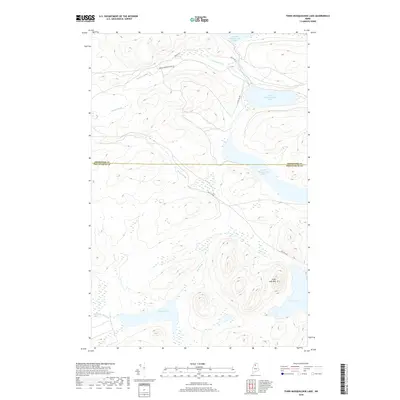
2018 Map of Third Musquacook Lake
USGS Topo · Published 2018About this map
Third Musquacook Lake and its neighboring waters define this interior Maine landscape, where the northern boundary of Piscataquis County meets Aroostook County. The terrain is characterized by a dense network of glacial lakes and watercourses, including Fourth Musquacook Lake and the smaller Harrow Lake. A significant geological feature, Clear Lake Mtn, rises between the waters of Clear Lake and the winding Bog Brook.
Find a feature on this map
17 named features on this map. Tap any name to fly to it.
Don’t see what you’re looking for? This feature index may not catch every label — zoom into the map to look around manually.
Map Details
Editions of this 2018 Third Musquacook Lake Map
This is the sole edition of this map. No revisions or reprints were ever made.
Other maps of this area

1932 · Umsaskis Lake
USGS Topo · 1:48,000

1932 · Musquacook Lakes
USGS Topo · 1:48,000

1935 · Umsaskis Lake
USGS Topo · 1:62,500

1935 · Musquacook Lakes
USGS Topo · 1:62,500

1954 · Spider Lake
USGS Topo · 1:62,500

1954 · Churchill Lake
USGS Topo · 1:62,500

1954 · Presque Isle
USGS Topo · 1:250,000

1958 · Presque Isle
USGS Topo · 1:250,000

1960 · Presque Isle
USGS Topo · 1:250,000

1961 · Spider Lake
USGS Topo · 1:62,500