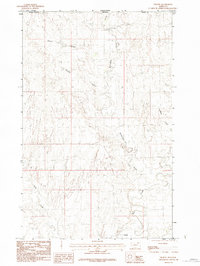
1984 Map of Thoeny
USGS Topo · Published 1984About this map
The Canada-United States border defines the northern edge of this high plains landscape in Valley County, Montana. The settlement of Thoeny sits near the southern boundary, positioned within a network of drainage features that dominate the local topography. This 1984 provisional survey illustrates the intermittent nature of the prairie hydrology, where watercourses like Mc Eachern Creek and Chambers Creek carve intricate paths across the terrain. These coulees, including Dolson Coulee and Davison Coulee, represent the primary natural landmarks in an area otherwise characterized by its openness and proximity to the international line with Saskatchewan. A prominent landform labeled simply as Bluff stands out in the southwest, while Rock Creek provides further evidence of the region's seasonal water flow. The map captures a moment in the mid-1980s before modern agricultural or infrastructure changes altered this borderland ranching country.
Find a feature on this map
10 named features on this map. Tap any name to fly to it.
Don’t see what you’re looking for? This feature index may not catch every label — zoom into the map to look around manually.
Map Details
Editions of this 1984 Thoeny Map
This is the sole edition of this map. No revisions or reprints were ever made.
Other maps of this area

1919 · Boundary
USGS Topo · 1:125,000

1954 · Glasgow
USGS Topo · 1:250,000

1957 · Glasgow
USGS Topo · 1:250,000

1958 · Glasgow
USGS Topo · 1:250,000

1984 · Lighthouse Hill
USGS Topo · 1:24,000

1984 · Snake Creek School
USGS Topo · 1:24,000

1984 · Black Calf Reservoir
USGS Topo · 1:24,000

1984 · Opheim
USGS Topo · 1:100,000

1984 · Last Chance Reservoir
USGS Topo · 1:24,000
1984 · Antelope Pass
USGS Topo · 1:24,000