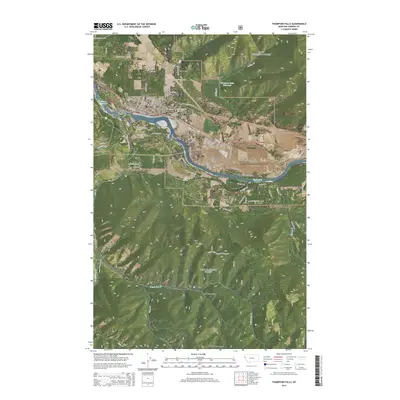
2014 Map of Thompson Falls
USGS Topo · Published 2014About this map
Thompson Falls serves as the focal point of this 2014 survey, positioned where the Clark Fork river is punctuated by a series of hydroelectric developments and islands. The community's local history is anchored by several burial grounds, including the Wild Rose Cem, Fraternal Cem, and View Cem, while the Thompson Falls Airport and a grid of residential streets like Haley Ave W show the town's modern footprint.
Find a feature on this map
110 named features on this map. Tap any name to fly to it.
Don’t see what you’re looking for? This feature index may not catch every label — zoom into the map to look around manually.
Map Details
Editions of this 2014 Thompson Falls Map
This is the sole edition of this map. No revisions or reprints were ever made.
Other maps of this area

1918 · St Regis
USGS Topo · 1:125,000

1919 · St. Regis
USGS Topo · 1:125,000

1937 · Thompson Falls
USGS Topo · 1:125,000

1937 · Thompson Falls
USGS Topo · 1:62,500

1956 · St Regis
USGS Topo · 1:62,500

1956 · Wallace
USGS Topo · 1:250,000

1957 · Thompson Falls
USGS Topo · 1:62,500

1957 · Haugan
USGS Topo · 1:62,500

1960 · Wallace
USGS Topo · 1:250,000

1964 · Eddy Mountain
USGS Topo · 1:24,000