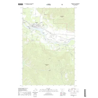
2020 Map of Thompson Falls
USGS Topo · Published 2020About this map
Thompson Falls occupies a strategic position along the north bank of the Clark Fork, where civil infrastructure meets the wilderness of the Lolo National Forest. The town's grid is anchored by the Sanders County Courthouse and extends toward the Thompson Falls Reservoir, which is spanned by the Main Channel Bridge and Dry Channel Bridge. Genealogists will find the Wild Rose Cem and the Veterans of Foreign Wars Cem situated on the eastern edge of the settlement near Grizzly Dr. Beyond the town, the topography rises sharply toward Clark Mtn and Elk Point, reflecting the region's mining and timber heritage through features like Gold Rush Gulch and various forest service road networks. The Thompson Falls Airport sits on a plateau south of the river, highlighting the area's modern connectivity within this complex river valley.
Find a feature on this map
89 named features on this map. Tap any name to fly to it.
Don’t see what you’re looking for? This feature index may not catch every label — zoom into the map to look around manually.
Map Details
Editions of this 2020 Thompson Falls Map
This is the sole edition of this map. No revisions or reprints were ever made.
Other maps of this area

1918 · St Regis
USGS Topo · 1:125,000

1919 · St. Regis
USGS Topo · 1:125,000

1937 · Thompson Falls
USGS Topo · 1:125,000

1937 · Thompson Falls
USGS Topo · 1:62,500

1956 · St Regis
USGS Topo · 1:62,500

1956 · Wallace
USGS Topo · 1:250,000

1957 · Thompson Falls
USGS Topo · 1:62,500

1957 · Haugan
USGS Topo · 1:62,500

1960 · Wallace
USGS Topo · 1:250,000

1964 · Eddy Mountain
USGS Topo · 1:24,000