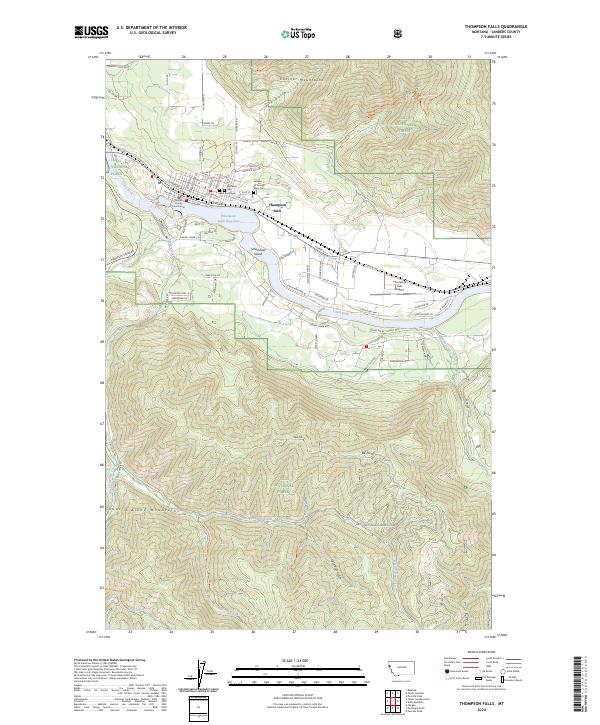
2024 Map of Thompson Falls
USGS Topo · Published 2024About this map
The Sanders County Courthouse anchors the settlement of Thompson Falls, situated along the northern banks of the Clark Fork. This 2024 map documents a landscape defined by the water of the Thompson Falls Reservoir and the surrounding peaks of the Cabinet Mountains to the north and the Coeur d'Alene Mountains to the south. Three local cemeteries—the Veterans of Foreign Wars Cem, Fraternal Cem, and Wild Rose Cem—provide significant points of interest for genealogists tracing family history in the area. The map also details the public lands of the Lolo National Forest and local infrastructure such as the Thompson Falls Airport and the Thompson Falls Fitness Trl. Smaller features like Steamboat Island and Moss Spring add fine-grained detail to the riparian corridor.
Find a feature on this map
93 named features on this map. Tap any name to fly to it.
Don’t see what you’re looking for? This feature index may not catch every label — zoom into the map to look around manually.
Map Details
Editions of this 2024 Thompson Falls Map
This is the sole edition of this map. No revisions or reprints were ever made.
Other maps of this area

1918 · St Regis
USGS Topo · 1:125,000

1919 · St. Regis
USGS Topo · 1:125,000

1937 · Thompson Falls
USGS Topo · 1:125,000

1937 · Thompson Falls
USGS Topo · 1:62,500

1956 · St Regis
USGS Topo · 1:62,500

1956 · Wallace
USGS Topo · 1:250,000

1957 · Thompson Falls
USGS Topo · 1:62,500

1957 · Haugan
USGS Topo · 1:62,500

1960 · Wallace
USGS Topo · 1:250,000

1964 · Eddy Mountain
USGS Topo · 1:24,000