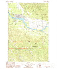
1988 Map of Thompson Falls
USGS Topo · Published 1988About this map
The Clark Fork defines the landscape of this Sanders County region, where the town of Thompson Falls sits at a critical bend in the river. This late-1980s topographic study captures the infrastructure of the valley, from the Thompson Falls Dam and its adjacent Thompson Falls Reservoir to the Noxon Res waters. The town's civic core is detailed with the Cem, High Sch, and a Sewage Disposal Pond, illustrating the community's mid-century footprint.
Find a feature on this map
27 named features on this map. Tap any name to fly to it.
Don’t see what you’re looking for? This feature index may not catch every label — zoom into the map to look around manually.
Map Details
Editions of this 1988 Thompson Falls Map
This is the sole edition of this map. No revisions or reprints were ever made.
Other maps of this area

1918 · St Regis
USGS Topo · 1:125,000

1919 · St. Regis
USGS Topo · 1:125,000

1937 · Thompson Falls
USGS Topo · 1:125,000

1937 · Thompson Falls
USGS Topo · 1:62,500

1956 · St Regis
USGS Topo · 1:62,500

1956 · Wallace
USGS Topo · 1:250,000

1957 · Thompson Falls
USGS Topo · 1:62,500

1957 · Haugan
USGS Topo · 1:62,500

1960 · Wallace
USGS Topo · 1:250,000

1964 · Eddy Mountain
USGS Topo · 1:24,000