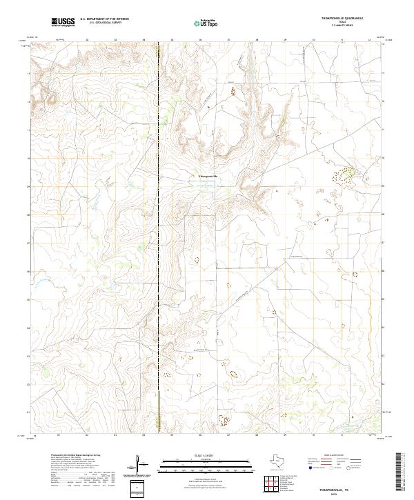
2022 Map of Thompsonville
USGS Topo · Published 2022About this map
Thompsonville sits within a landscape defined by the drainage of the Arroyo Grande, which winds through the central portion of this South Texas quadrangle. The area is characterized by large-scale ranching operations, marked by an extensive network of named thoroughfares such as Peyote Ranch Rd and Vela Pena Ranch Rd that provide access to the interior of these historic landholdings. To the south, Los Tanques Cr crosses the terrain near the southern boundary. This 2022 survey captures the modern road infrastructure, including FM 649 and FM 3073, while clearly delineating the political boundary between Zapata County and Jim Hogg County. The layout of the ranch roads, including Casa Blanca Ranch Rd and Aa Martinez Rd, reflects the enduring legacy of family ranching and traditional land use patterns in this part of the state.
Find a feature on this map
12 named features on this map. Tap any name to fly to it.
Don’t see what you’re looking for? This feature index may not catch every label — zoom into the map to look around manually.
Map Details
Editions of this 2022 Thompsonville Map
This is the sole edition of this map. No revisions or reprints were ever made.
Other maps of this area

1939 · Bruni
USGS Topo · 1:62,500

1939 · Randado
USGS Topo · 1:62,500

1940 · Aguilares
USGS Topo · 1:62,500

1940 · Randado
USGS Topo · 1:62,500

1940 · Mogotes Hill
USGS Topo · 1:62,500

1956 · Mogotes Hill
USGS Topo · 1:62,500

1956 · Laredo
USGS Topo · 1:250,000

1972 · Armstrong Ranch
USGS Topo · 1:24,000
1972 · San Pablo Ranch
USGS Topo · 1:24,000

1972 · Albercas Ranch
USGS Topo · 1:24,000