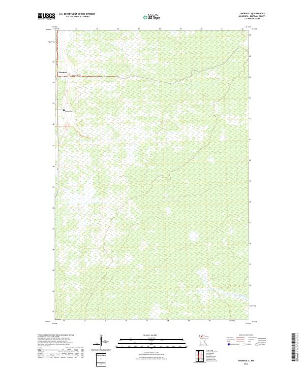
2022 Map of Thorhult
USGS Topo · Published 2022About this map
Thorhult serves as the primary landmark in this sparsely populated section of northern Beltrami County. The settlement character is defined by a remote grid of section lines and local roads like Thorhult Rd NW and Roen Rd NW. A significant portion of the landscape is dominated by extensive wetland complexes, typical of the region's flat, poorly drained terrain. For those researching local history or genealogy, the Rosebud Cem is a key feature located south of the main settlement. The Fourtown-Grygla Trail System Trl traverses the northern boundary, reflecting the area's modern use for recreation and timber access. In the southeastern corner, the meandering path of Manomin Cr provides a natural break in the otherwise uniform township and range subdivisions.
Find a feature on this map
10 named features on this map. Tap any name to fly to it.
Don’t see what you’re looking for? This feature index may not catch every label — zoom into the map to look around manually.
Map Details
Editions of this 2022 Thorhult Map
This is the sole edition of this map. No revisions or reprints were ever made.
Other maps of this area

1918 · F
USGS Topo · 1:62,500

1918 · Malcolm
USGS Topo · 1:62,500

1918 · Jelle
USGS Topo · 1:62,500

1954 · Roseau
USGS Topo · 1:250,000

1957 · Roseau
USGS Topo · 1:250,000

1958 · Roseau
USGS Topo · 1:250,000

1973 · Manomin Creek SE
USGS Topo · 1:24,000

1973 · Mosquito Creek
USGS Topo · 1:24,000

1973 · Manomin Creek
USGS Topo · 1:24,000

1973 · Jelle NE
USGS Topo · 1:24,000