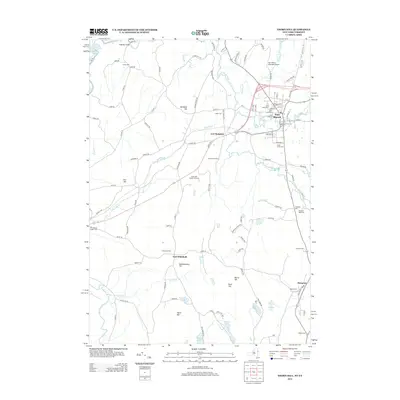
2013 Map of Thorn Hill
USGS Topo · Published 2013About this map
Fair Haven serves as a primary center of activity along the Castleton River, situated near the confluence where the Poultney River snakes through the valley floor. The landscape is defined by its agricultural heritage and numerous family landmarks, featuring orchards like Fairview Orchard and Green Hill Organic Orchard alongside established farms such as Ewetopia Farm and Yorkmont Farm. The region's history is deeply rooted in its many burial grounds, including the Old Half Cem, Saint Marys Cem, and Warren Cem, which offer significant value for genealogical research.
Find a feature on this map
113 named features on this map. Tap any name to fly to it.
Don’t see what you’re looking for? This feature index may not catch every label — zoom into the map to look around manually.
Map Details
Editions of this 2013 Thorn Hill Map
This is the sole edition of this map. No revisions or reprints were ever made.
Other maps of this area

1893 · Fort Ann
USGS Topo · 1:62,500

1893 · Whitehall
USGS Topo · 1:62,500

1894 · Pawlet
USGS Topo · 1:62,500

1895 · Whitehall
USGS Topo · 1:62,500

1895 · Fort Ann
USGS Topo · 1:62,500

1895 · Castleton
USGS Topo · 1:62,500

1897 · Pawlet
USGS Topo · 1:62,500

1897 · Castleton
USGS Topo · 1:62,500

1898 · Whitehall
USGS Topo · 1:62,500

1898 · Fort Ann
USGS Topo · 1:62,500