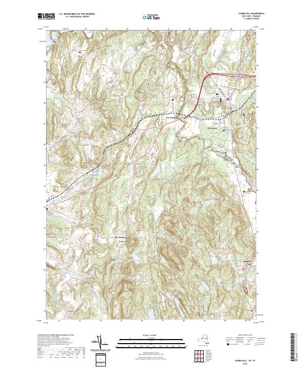
2023 Map of Thorn Hill
USGS Topo · Published 2023About this map
The Poultney River and Castleton River converge near the state line in this survey of the borderlands between New York and Vermont. The landscape is defined by a dense concentration of early burial grounds near Fair Haven, including Saint Mary's Cem, the Old North Half Cem, and Old South Half Cem. These sites, along with Cedar Grove Cem, provide a significant focal point for genealogical research in a region where settlement patterns were dictated by the fertile valleys of Mud Brook and the Mettawee River.
Find a feature on this map
102 named features on this map. Tap any name to fly to it.
Don’t see what you’re looking for? This feature index may not catch every label — zoom into the map to look around manually.
Map Details
Editions of this 2023 Thorn Hill Map
This is the sole edition of this map. No revisions or reprints were ever made.
Other maps of this area

1893 · Fort Ann
USGS Topo · 1:62,500

1893 · Whitehall
USGS Topo · 1:62,500

1894 · Pawlet
USGS Topo · 1:62,500

1895 · Whitehall
USGS Topo · 1:62,500

1895 · Fort Ann
USGS Topo · 1:62,500

1895 · Castleton
USGS Topo · 1:62,500

1897 · Pawlet
USGS Topo · 1:62,500

1897 · Castleton
USGS Topo · 1:62,500

1898 · Whitehall
USGS Topo · 1:62,500

1898 · Fort Ann
USGS Topo · 1:62,500