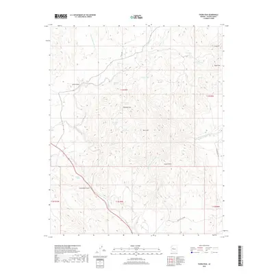
2018 Map of Thorn Peak
USGS Topo · Published 2018About this map
Thorn Peak and Whitecap Peak dominate this corner of the Mojave Desert in Yavapai County, marking a landscape defined by significant elevation changes and seasonal water sources. The drainages of Bridle Cr and the Santa Maria River North Fork carve through the terrain, supported by a network of vital tanks and springs such as Moonshine Spring, Highway Spring, and Pastore Tank. These water features were essential for ranching and travel in this arid region, as evidenced by the namesake Thorn Peak Tank and Crosby Mountain Tank. To the south, the Santa Maria River Rd provides one of the few established transit corridors through the drainage basins of Cottonwood Canyon and Skunk Canyon. The mapping of these remote peaks, including Crosby Mtn and Hayes Peak, illustrates the challenging topography of the Arizona desert borderlands during the early 21st century.
Find a feature on this map
33 named features on this map. Tap any name to fly to it.
Don’t see what you’re looking for? This feature index may not catch every label — zoom into the map to look around manually.
Map Details
Editions of this 2018 Thorn Peak Map
This is the sole edition of this map. No revisions or reprints were ever made.
Other maps of this area

1923 · Signal
USGS Topo · 1:250,000

1942 · Signal
USGS Topo · 1:250,000

1945 · Bagdad
USGS Topo · 1:62,500

1948 · Bagdad
USGS Topo · 1:62,500

1950 · Prescott
USGS Topo · 1:250,000

1954 · Prescott
USGS Topo · 1:250,000

1958 · Prescott
USGS Topo · 1:250,000

1959 · Prescott
USGS Topo · 1:250,000

1960 · Prescott
USGS Topo · 1:250,000

1965 · Prescott
USGS Topo · 1:250,000