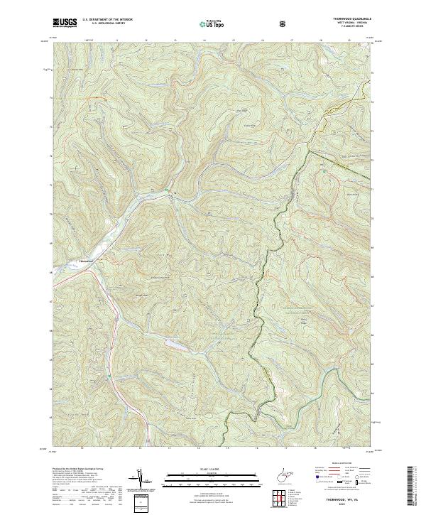
2023 Map of Thornwood
USGS Topo · Published 2023About this map
Thornwood sits at the confluence of several mountain drainages where the East Fork Greenbrier River begins its course. This highland region is defined by the intersection of the Monongahela National Forest and George Washington National Forest, creating a landscape of high-elevation knobs and ridges. Prominent peaks such as Smoke Camp Knob, Colaw Knob, and Rough Knob dictate the movement of local waters like Buffalo Fork and Bearwallow Run.
Find a feature on this map
72 named features on this map. Tap any name to fly to it.
Don’t see what you’re looking for? This feature index may not catch every label — zoom into the map to look around manually.
Map Details
Editions of this 2023 Thornwood Map
This is the sole edition of this map. No revisions or reprints were ever made.
Other maps of this area

1889 · Beverly
USGS Topo · 1:125,000

1892 · Beverly
USGS Topo · 1:125,000

1901 · Monterey
USGS Topo · 1:125,000

1922 · Spruce Knob
USGS Topo · 1:48,000

1922 · Cass
USGS Topo · 1:48,000

1922 · Durbin
USGS Topo · 1:48,000

1924 · Cass
USGS Topo · 1:62,500

1924 · Durbin
USGS Topo · 1:62,500

1924 · Spruce Knob
USGS Topo · 1:62,500

1941 · Monterey
USGS Topo · 1:62,500