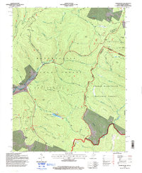
1995 Map of Thornwood
USGS Topo · Published 1998About this map
Thornwood and its surroundings in the mid-1990s reveal a landscape defined by the convergence of the Monongahela National Forest and George Washington National Forest. The map documents the intricate drainage system of the East Fork Greenbrier River, where numerous runs like Abes Run and Poca Run carve through high ridges. A notable point of human activity is Camp Pocahontas (USFS), situated along the upper reaches of the river.
Find a feature on this map
68 named features on this map. Tap any name to fly to it.
Don’t see what you’re looking for? This feature index may not catch every label — zoom into the map to look around manually.
Map Details
Editions of this 1995 Thornwood Map
This is the sole edition of this map. No revisions or reprints were ever made.
Other maps of this area

1889 · Beverly
USGS Topo · 1:125,000

1892 · Beverly
USGS Topo · 1:125,000

1901 · Monterey
USGS Topo · 1:125,000

1922 · Spruce Knob
USGS Topo · 1:48,000

1922 · Cass
USGS Topo · 1:48,000

1922 · Durbin
USGS Topo · 1:48,000

1924 · Cass
USGS Topo · 1:62,500

1924 · Durbin
USGS Topo · 1:62,500

1924 · Spruce Knob
USGS Topo · 1:62,500

1941 · Monterey
USGS Topo · 1:62,500