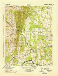
1944 Map of Thorofare Gap
USGS Topo · Published 1944About this map
Bull Run Mountains dominate this 1944 landscape, forming a prominent natural barrier that dictates the passage of roads and rails. The most significant gap in this terrain, Thorofare Gap, serves as a critical corridor for the Southern Railway and a major road, facilitating movement between Prince William and Fauquier counties. This strategic topography is punctuated by industrial and agricultural activity, from the milling at Beverly Mills to the extraction at Sisslers Quarry and Paynes Quarry.
Find a feature on this map
39 named features on this map. Tap any name to fly to it.
Don’t see what you’re looking for? This feature index may not catch every label — zoom into the map to look around manually.
Map Details
Editions of this 1944 Thorofare Gap Map
This is the sole edition of this map. No revisions or reprints were ever made.
Other maps of this area

1894 · Warrenton
USGS Topo · 1:125,000

1894 · Warrenton
USGS Topo · 1:62,500

1927 · Remington
USGS Topo · 1:48,000

1930 · Warrenton
USGS Topo · 1:62,500

1933 · Middleburg
USGS Topo · 1:62,500

1943 · Catlett
USGS Topo · 1:62,500

1943 · Arcola
USGS Topo · 1:24,000

1943 · Thorofare Gap
USGS Topo · 1:24,000

1943 · Marshall
USGS Topo · 1:24,000

1943 · Rectortown
USGS Topo · 1:24,000