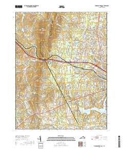
2019 Map of Thoroughfare Gap
USGS Topo · Published 2019About this map
Thoroughfare Gap serves as the focal point of this landscape, where the Bull Run Mountains part to allow the passage of Broad Run and major transport routes. This 2019 survey captures the developed corridor of Gainesville and Haymarket as they expand toward the more rural terrain of the Fauquier Co and Prince William Co line. Significant industrial and social history is grounded in labels like Beverley Mill, situated at the gap’s narrowest point, and several small burial grounds including Beulah Cem and Saint Pauls Cem.
Find a feature on this map
195 named features on this map. Tap any name to fly to it.
Don’t see what you’re looking for? This feature index may not catch every label — zoom into the map to look around manually.
Map Details
Editions of this 2019 Thoroughfare Gap Map
This is the sole edition of this map. No revisions or reprints were ever made.
Other maps of this area

1894 · Warrenton
USGS Topo · 1:125,000

1894 · Warrenton
USGS Topo · 1:62,500

1927 · Remington
USGS Topo · 1:48,000

1930 · Warrenton
USGS Topo · 1:62,500

1933 · Middleburg
USGS Topo · 1:62,500

1943 · Catlett
USGS Topo · 1:62,500

1943 · Arcola
USGS Topo · 1:24,000

1943 · Thorofare Gap
USGS Topo · 1:24,000

1943 · Marshall
USGS Topo · 1:24,000

1943 · Rectortown
USGS Topo · 1:24,000