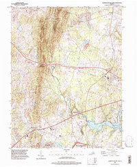
1994 Map of Thoroughfare Gap
USGS Topo · Published 1998About this map
The Bull Run Mountains form a dramatic north-south spine across this landscape, creating the historic passage at Thoroughfare Gap. This mid-1990s record captures the region as suburban expansion from the east begins to meet the established rural character of the Pond Mountains and Baldwin Ridge. In the southeast, the massive Lake Manassas reservoir dominates the drainage of Broad Run, while the northern reaches maintain a network of small settlements like Waterfall, Antioch, and Woolsey.
Find a feature on this map
40 named features on this map. Tap any name to fly to it.
Don’t see what you’re looking for? This feature index may not catch every label — zoom into the map to look around manually.
Map Details
Editions of this 1994 Thoroughfare Gap Map
This is the sole edition of this map. No revisions or reprints were ever made.
Other maps of this area

1894 · Warrenton
USGS Topo · 1:125,000

1894 · Warrenton
USGS Topo · 1:62,500

1927 · Remington
USGS Topo · 1:48,000

1930 · Warrenton
USGS Topo · 1:62,500

1933 · Middleburg
USGS Topo · 1:62,500

1943 · Catlett
USGS Topo · 1:62,500

1943 · Arcola
USGS Topo · 1:24,000

1943 · Thorofare Gap
USGS Topo · 1:24,000

1943 · Marshall
USGS Topo · 1:24,000

1943 · Rectortown
USGS Topo · 1:24,000