
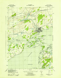
1943 Map of Thousand Island Park
USGS Topo · Published 1943About this map
Thousand Island Park and the surrounding archipelago of the St Lawrence River appear here in wartime detail, mapping the complex international border between the Dominion of Canada and the United States. The landscape is defined by its massive islands, including Wells Island and Grindstone Island, which are home to established communities and rural schools like School No 1 and School No 8. River navigation is heavily emphasized, with numerous navigational aids such as the Granite State Shoal Light and Chapman Shoal LH marking the safe passages for vessels moving between Eel Bay and Lake of the Isles.
Find a feature on this map
39 named features on this map. Tap any name to fly to it.
Don’t see what you’re looking for? This feature index may not catch every label — zoom into the map to look around manually.
Map Details
Editions of this 1943 Thousand Island Park Map
This is the sole edition of this map. No revisions or reprints were ever made.
Other maps of this area

1900 · Clayton
USGS Topo · 1:62,500

1903 · Grindstone
USGS Topo · 1:62,500

1903 · Clayton
USGS Topo · 1:62,500

1903 · Alexandria Bay
USGS Topo · 1:62,500

1903 · Theresa
USGS Topo · 1:62,500

1942 · Sawmill Bay
USGS Topo · 1:31,680

1942 · Clayton
USGS Topo · 1:24,000

1943 · Clayton
USGS Topo · 1:31,680

1943 · Lafargeville
USGS Topo · 1:31,680
1943 · Grindstone
USGS Topo · 1:31,680