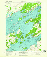
1958 Map of Thousand Island Park
USGS Topo · Published 1960About this map
The St Lawrence River serves as the international boundary on this 1958 survey, dividing the American and Canadian archipelagos. On the New York side, the Victorian-era resort character of Thousand Island Park is evident on Wellesley Island, surrounded by established riverfront communities like Fineview, Grenell, and the mainland hub of Fishers Landing. The intricate waterways of the Lake Fleet Islands and The Admiralty Islands are meticulously mapped, showing the complex navigation through The Narrows and Eel Bay. Local industrial history is noted by the Quarries on Picton Island, while conservation efforts are reflected in the early footprints of St Lawrence Islands National Park and Waterson Point Park. Small family sites, such as a Cem on Grindstone Island, provide valuable touchpoints for genealogists.
Find a feature on this map
141 named features on this map. Tap any name to fly to it.
Don’t see what you’re looking for? This feature index may not catch every label — zoom into the map to look around manually.
Map Details
Editions of this 1958 Thousand Island Park Map
3 editions found
Other maps of this area

1900 · Clayton
USGS Topo · 1:62,500

1903 · Grindstone
USGS Topo · 1:62,500

1903 · Clayton
USGS Topo · 1:62,500

1903 · Alexandria Bay
USGS Topo · 1:62,500

1903 · Theresa
USGS Topo · 1:62,500

1942 · Sawmill Bay
USGS Topo · 1:31,680

1942 · Clayton
USGS Topo · 1:24,000

1943 · Thousand Island Park
USGS Topo · 1:31,680

1943 · Clayton
USGS Topo · 1:31,680

1943 · Lafargeville
USGS Topo · 1:31,680