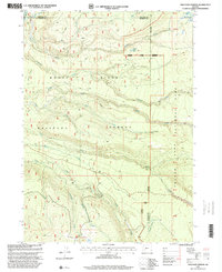
1997 Map of Thousand Springs
USGS Topo · Published 2000About this map
Rogue River National Forest and the western edge of Crater Lake National Park meet in this high-altitude landscape dominated by seasonal waterways and volcanic terrain. The map centers on the headwaters of several significant drainages, including Copeland Creek, Bybee Creek, and Union Creek, which carve through the timbered slopes. Of particular note is the Thousand Springs area near the eastern boundary, where numerous springs emerge to form the source of local waters. Evidence of early travel and forest use is found at Wagon Camp and the prominent heights of Huckleberry Mtn. The topography is further characterized by specialized ecosystems such as Sphagnum Bog and the secluded Spruce Lake. This survey illustrates the intricate network of forest roads and trails that provided access to these remote reaches for resource management and recreation during the late twentieth century.
Find a feature on this map
22 named features on this map. Tap any name to fly to it.
Don’t see what you’re looking for? This feature index may not catch every label — zoom into the map to look around manually.
Map Details
Editions of this 1997 Thousand Springs Map
This is the sole edition of this map. No revisions or reprints were ever made.
Other maps of this area

1891 · Ashland
USGS Topo · 1:250,000

1893 · Ashland
USGS Topo · 1:250,000

1897 · Ashland
USGS Topo · 1:250,000

1917 · Diamond Lake
USGS Topo · 1:125,000

1955 · Medford
USGS Topo · 1:250,000

1956 · Diamond Lake
USGS Topo · 1:62,500

1956 · Garwood Butte
USGS Topo · 1:62,500

1956 · Prospect
USGS Topo · 1:62,500

1957 · Medford
USGS Topo · 1:250,000

1958 · Medford
USGS Topo · 1:250,000