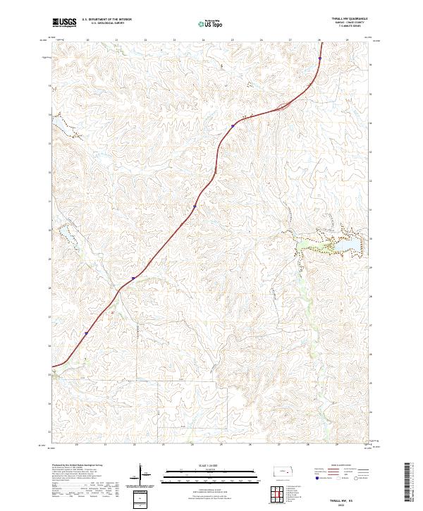
2022 Map of Thrall NW
USGS Topo · Published 2022About this map
The N Br Verdigris River carves through the central portion of this Chase County landscape, defining a network of drainage systems that support the Flint Hills prairie. The terrain is characterized by the branching headwaters of several notable streams, including Norton Cr and Bloody Cr in the north, and Sharpes Cr winding through the western sections. The rural infrastructure of the early twenty-first century is preserved here through a grid of section-line roads and specialized access routes such as Sharpes Creek Rd and Camp Creek Rd. The presence of labels like Pvt Rd - Permission Required and Pasture Access Rd reflects the modern management of these large grazing tracts, where traditional ranching operations remain the primary economic driver. These private corridors connect isolated upland pastures to the valley floors of Shaw Cr and Little Cedar Cr.
Find a feature on this map
23 named features on this map. Tap any name to fly to it.
Don’t see what you’re looking for? This feature index may not catch every label — zoom into the map to look around manually.
Map Details
Editions of this 2022 Thrall NW Map
This is the sole edition of this map. No revisions or reprints were ever made.
Other maps of this area

1888 · Emporia
USGS Topo · 1:125,000

1894 · Emporia
USGS Topo · 1:125,000

1898 · Cottonwood Falls
USGS Topo · 1:125,000

1955 · Hutchinson
USGS Topo · 1:250,000

1959 · Hutchinson
USGS Topo · 1:250,000
1967 · Thrall
USGS Topo · 1:24,000
1967 · Teterville
USGS Topo · 1:24,000
1967 · Matfield Green SE
USGS Topo · 1:24,000

1973 · Matfield Green
USGS Topo · 1:24,000

1973 · Shaw Creek
USGS Topo · 1:24,000