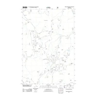
2011 Map of Three Brothers
USGS Topo · Published 2011About this map
Bullion Mine and the Ontario Millsite stand as central landmarks in this high-elevation mining landscape near the continental divide. The terrain is defined by a dense concentration of mineral claims and extraction sites, ranging from the Paupers Dream Mine to the Sure Thing Mine, many clustered around the drainages of Telegraph Creek and Ontario Creek. Small settlements and named camps such as Hub Camp, Bullion Parks, and Jimmy are situated among the peaks, providing rare points of habitation in the mountain geography. This area’s heavy industrial legacy is recorded in detail, showing how mines like the Beatrice Mine and Champion Mine are deeply integrated into the gulches and ridges that define the watershed. Between high points like Jericho Mountain and Old Baldy Mountain, a network of unimproved roads and trails connects these remote workings to the larger valleys below.
Find a feature on this map
133 named features on this map. Tap any name to fly to it.
Don’t see what you’re looking for? This feature index may not catch every label — zoom into the map to look around manually.
Map Details
Editions of this 2011 Three Brothers Map
This is the sole edition of this map. No revisions or reprints were ever made.
Other maps of this area

1889 · Helena
USGS Topo · 1:250,000

1893 · Helena
USGS Topo · 1:250,000

1899 · Boulder
USGS Topo · 1:125,000

1899 · Helena
USGS Topo · 1:250,000

1903 · Helena
USGS Topo · 1:250,000

1947 · Butte
USGS Topo · 1:250,000

1950 · Jefferson City
USGS Topo · 1:62,500

1950 · Helena
USGS Topo · 1:62,500

1954 · Basin
USGS Topo · 1:62,500

1958 · Butte
USGS Topo · 1:250,000