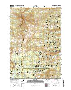
2017 Map of Three Fingered Jack
USGS Topo · Published 2017About this map
Three Fingered Jack dominates the skyline of the Cascade Range, marking a dramatic intersection where the borders of Linn, Jefferson, and Deschutes counties meet. This 2017 survey details a landscape defined by volcanic landmarks and an extensive network of high-elevation trails, including the Pacific Crest National Scenic Trail and the historic Old Summit route. The area around Santiam Pass serves as a central corridor for modern and traditional travel, surrounded by distinctive geologic formations like Hayrick Butte and Claypool Butte. A dense concentration of alpine water bodies, from the larger Suttle Lake and Big Lake to smaller basins like Square Lake and Booth Lake, illustrates the glaciated character of the terrain. The map also highlights significant recreational and ecological zones within the Willamette National Forest and Deschutes National Forest, such as the verdant Canyon Creek Meadows.
Find a feature on this map
89 named features on this map. Tap any name to fly to it.
Don’t see what you’re looking for? This feature index may not catch every label — zoom into the map to look around manually.
Map Details
Editions of this 2017 Three Fingered Jack Map
This is the sole edition of this map. No revisions or reprints were ever made.
Other maps of this area

1927 · Mt. Jefferson
USGS Topo · 1:125,000

1929 · Three Sisters
USGS Topo · 1:125,000

1930 · Mt. Jefferson
USGS Topo · 1:125,000

1932 · Three Sisters
USGS Topo · 1:125,000

1955 · Bend
USGS Topo · 1:250,000

1957 · Bend
USGS Topo · 1:250,000

1958 · Bend
USGS Topo · 1:250,000

1959 · Three Fingered Jack
USGS Topo · 1:62,500

1959 · Sisters
USGS Topo · 1:62,500

1961 · Whitewater River
USGS Topo · 1:62,500