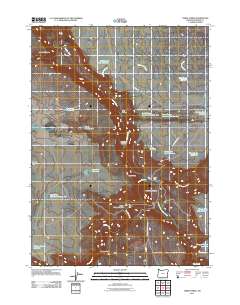
2011 Map of Three Forks
USGS Topo · Published 2011About this map
The confluence of three river branches defines this remote section of Malheur County, where the Owyhee River meets the North Fork Owyhee River and Middle Fork Owyhee River. This 2011 survey captures a landscape dominated by deep basalt canyons and a high-desert drainage network, centered on the historic river crossing at Three Forks. The topographical data shows the steep ascent of the Military Grade and the prominent Three Forks Dome, reflecting a territory where water management is critical for land use. A dense network of small-scale impoundments like Lone Tree Reservoir, Whitehorse Creek Reservoir, and Squaw Flat Reservoir Number Two are scattered across the flats and canyons, illustrating the vital infrastructure required for ranching operations. Remote access is traced through primitive routes such as 3 Forks Rd and Fenwick Ranch Rd, which connect isolated features like Whiskey Gulch and Porcupine Canyon to the wider region.
Find a feature on this map
33 named features on this map. Tap any name to fly to it.
Don’t see what you’re looking for? This feature index may not catch every label — zoom into the map to look around manually.
Map Details
Editions of this 2011 Three Forks Map
This is the sole edition of this map. No revisions or reprints were ever made.
Other maps of this area

1955 · Jordan Valley
USGS Topo · 1:250,000

1957 · Jordan Valley
USGS Topo · 1:250,000

1958 · Jordan Valley
USGS Topo · 1:250,000

1980 · Brewster Reservoir
USGS Topo · 1:24,000
1980 · Skull Creek
USGS Topo · 1:24,000

1980 · Three Forks
USGS Topo · 1:24,000

1980 · Juniper Point
USGS Topo · 1:24,000
1980 · Squaw Flat
USGS Topo · 1:24,000
1980 · Whitehorse Butte
USGS Topo · 1:24,000
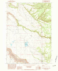
1982 · Deacon Crossing
USGS Topo · 1:24,000