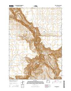
2014 Map of Three Forks
USGS Topo · Published 2014About this map
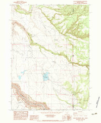
Three Forks sits at the dramatic confluence where the North Fork Owyhee River, Middle Fork Owyhee River, and the main stem of the Owyhee River meet in a deep, winding canyon system. This 2014 survey reveals a landscape shaped by water management and natural geothermal features, notably Tudor Warm Springs located near the river's edge. The high desert plateaus of Squaw Flat and Brown Ridge overlook a complex network of rimrocks and gulches, including Whiskey Gulch and the steep Military Grade. Water security is a dominant theme of the modern era, evidenced by numerous small-scale impoundments like Long Canyon Reservoir Number One, Division Fence Reservoir, and Squaw Flat Reservoir Number Two. These features, along with the Three Forks Rim Reservoir, indicate the critical role of ranching and livestock infrastructure in this arid corner of Malheur County.
Find a feature on this map
36 named features on this map. Tap any name to fly to it.
Don’t see what you’re looking for? This feature index may not catch every label — zoom into the map to look around manually.
Map Details
Editions of this 2014 Three Forks Map
This is the sole edition of this map. No revisions or reprints were ever made.
Other maps of this area

1955 · Jordan Valley
USGS Topo · 1:250,000

1957 · Jordan Valley
USGS Topo · 1:250,000

1958 · Jordan Valley
USGS Topo · 1:250,000

1980 · Brewster Reservoir
USGS Topo · 1:24,000
1980 · Skull Creek
USGS Topo · 1:24,000

1980 · Three Forks
USGS Topo · 1:24,000

1980 · Juniper Point
USGS Topo · 1:24,000
1980 · Squaw Flat
USGS Topo · 1:24,000
1980 · Whitehorse Butte
USGS Topo · 1:24,000
1982 · Deacon Crossing
USGS Topo · 1:24,000