1938 Map of Three Lakes
USGS Topo · Published 1964About this map
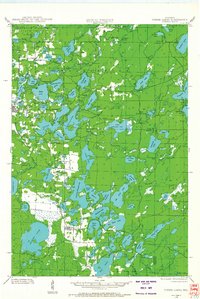
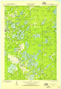
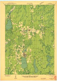
The town of Three Lakes and the adjacent village of Eagle River anchor this late-1930s depiction of the Northwoods at the junction of Vilas, Oneida, and Forest counties. The landscape is dominated by a dense network of glacial water bodies, from the vast Eagle Lake and Scattering Rice Lake to smaller reaches like Finger Lake and Spirit Lake. This era shows the region's transition into a recreational and conservation hub, with significant acreage designated as the Northern Highland State Forest. Local education and transport are well-defined, featuring rural landmarks like Mayo Sch 11, Sanborn Sch, and Evergreen Sch, all connected by the Chicago and Northwestern rail line and State Trunk Highway No 26. The map captures the intricate hydrology of the area, including the headwaters of Blackjack Creek and the meandering Little Deerskin River.
Find a feature on this map
92 named features on this map. Tap any name to fly to it.
Don’t see what you’re looking for? This feature index may not catch every label — zoom into the map to look around manually.
Map Details
Editions of this 1938 Three Lakes Map
2 editions found
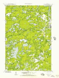
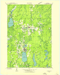
Other maps of this area

1928 · Three Lakes
USGS Topo · 1:48,000

1930 · Robbins
USGS Topo · 1:48,000

1938 · Phelps
USGS Topo · 1:48,000

1938 · Alvin
USGS Topo · 1:48,000
1938 · Three Lakes
USGS Topo · 1:48,000
1938 · Robbins
USGS Topo · 1:48,000
1939 · Crandon
USGS Topo · 1:48,000

1940 · Monico
USGS Topo · 1:48,000

1940 · Rhinelander
USGS Topo · 1:48,000
1941 · Crandon
USGS Topo · 1:48,000