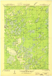
1945 Map of Three Lakes
USGS Topo · Published 1950About this map
Glacial lakes and dense forests dominate this mid-century landscape of northern Wisconsin, where the town of Three Lakes serves as a vital hub for the region's burgeoning recreational and timber economies. The Chicago and Northwestern Railways cuts a north-south line through the terrain, connecting the settlement to Eagle River and providing a lifeline for remote outposts. Significant tracts of the Northern Highland State Forest appear in the northern sections, signaling the importance of state-managed conservation. A dense network of waterways, including Cranberry Lake, Catfish Lake, and the winding Deerskin River, illustrates the complex hydrologic system that defined local transportation and settlement patterns. Rural education is marked by the presence of local schoolhouses like Evergreen Sch, Sanborn Sch, and Mayo Sch, reflecting the distributed nature of the community before later school consolidation changed the social geography of the Northwoods.
Find a feature on this map
97 named features on this map. Tap any name to fly to it.
Don’t see what you’re looking for? This feature index may not catch every label — zoom into the map to look around manually.
Map Details
Editions of this 1945 Three Lakes Map
3 editions found

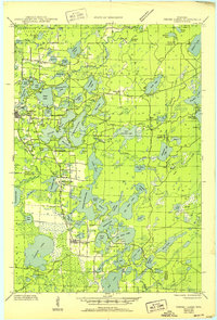
Other maps of this area

1928 · Three Lakes
USGS Topo · 1:48,000

1930 · Robbins
USGS Topo · 1:48,000

1938 · Phelps
USGS Topo · 1:48,000

1938 · Alvin
USGS Topo · 1:48,000

1938 · Three Lakes
USGS Topo · 1:48,000

1938 · Robbins
USGS Topo · 1:48,000

1939 · Crandon
USGS Topo · 1:48,000

1940 · Monico
USGS Topo · 1:48,000

1940 · Rhinelander
USGS Topo · 1:48,000

1941 · Crandon
USGS Topo · 1:48,000