1970 Map of Three Lakes
USGS Topo · Published 1972About this map
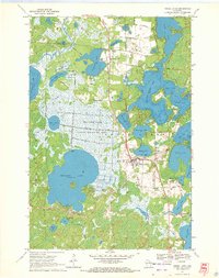
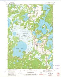
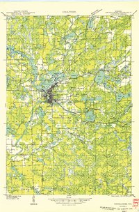
Thunder Lake State Wildlife Area dominates the central landscape of this 1970s survey, illustrating a region defined by its complex glacial hydrology and industrial agriculture. The map captures the community of Three Lakes at a time when the Chicago and North Western railroad still served as a primary transit artery through the lake country. To the north, Clearwater Lake sits near a specialized landscape of cranberry bogs, indicating the region's reliance on peatland cultivation alongside its growing reputation as a vacation destination.
Find a feature on this map
49 named features on this map. Tap any name to fly to it.
Don’t see what you’re looking for? This feature index may not catch every label — zoom into the map to look around manually.
Map Details
Editions of this 1970 Three Lakes Map
2 editions found
Other maps of this area

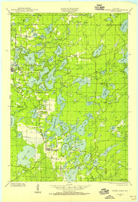
1928 · Three Lakes
USGS Topo · 1:48,000

1930 · Robbins
USGS Topo · 1:48,000
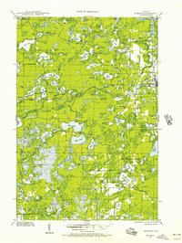
1938 · Three Lakes
USGS Topo · 1:48,000
1938 · Robbins
USGS Topo · 1:48,000

1940 · Monico
USGS Topo · 1:48,000

1940 · Rhinelander
USGS Topo · 1:48,000

1945 · Three Lakes
USGS Topo · 1:48,000

1945 · Robbins
USGS Topo · 1:48,000
1949 · Rhinelander
USGS Topo · 1:48,000

1950 · Monico
USGS Topo · 1:48,000