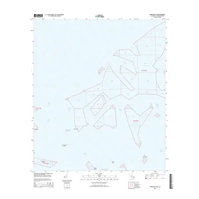
2015 Map of Three Mile Bay
USGS Topo · Published 2015About this map
The Gulf of Mexico dominates this coastal survey of Saint Bernard Parish, revealing a fragmented landscape of marshland, passes, and tidal bays. This 2015 data reflects the complex hydrology of the Louisiana shoreline, where Three Mile Pass and Three Mile Bay serve as critical conduits between larger bodies like Bay Boudreau and the open gulf. The mapping highlights the transient nature of the region's landforms, featuring low-lying landmarks such as Raccoon Island, Little Raccoon Island, and Mink Island. Intricate waterway networks including Johnson Bayou, Drum Bayou, and Picnic Bayou illustrate the labyrinthine drainage patterns characteristic of the deltaic environment. Notable points like Shell Point and Negro Point provide fixed geographic references for navigators and coastal researchers studying this fluid landscape.
Find a feature on this map
24 named features on this map. Tap any name to fly to it.
Don’t see what you’re looking for? This feature index may not catch every label — zoom into the map to look around manually.
Map Details
Editions of this 2015 Three Mile Bay Map
This is the sole edition of this map. No revisions or reprints were ever made.
Other maps of this area

1893 · Cat Island
USGS Topo · 1:62,500

1893 · Chandeleur
USGS Topo · 1:62,500

1893 · Toulme
USGS Topo · 1:62,500

1895 · Bodreau
USGS Topo · 1:62,500

1935 · Grand Island Pass
USGS Topo · 1:31,680

1935 · Mitchell Keys
USGS Topo · 1:31,680

1946 · Oak Mound Bayou
USGS Topo · 1:31,680

1946 · Isle Au Pitre
USGS Topo · 1:31,680

1946 · Lake Eugenie
USGS Topo · 1:31,680

1946 · Malheureux Point
USGS Topo · 1:31,680