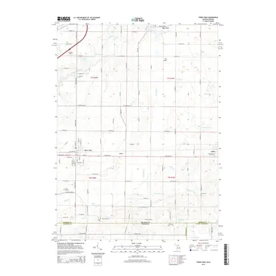
2014 Map of Three Oaks
USGS Topo · Published 2014About this map
Three Oaks serves as the central hub for this portion of Berrien County, situated just north of the Michigan-Indiana state line. The landscape is defined by the winding course of the Galien River and its various tributaries, including Beaverdam Cr and Dowling Cr, which drain the agricultural and wooded lands. Smaller communities such as New Troy, Avery, and Galien are connected by a grid of rural roads like W Kruger Rd and W Pulaski Hwy. The map provides significant detail for genealogists, marking several burial sites including Riverside Cem, Forest Lawn Cem, and the more isolated Germinder and Ward Graves. The presence of Benedick Airport and water bodies like Klutes Lakes and Lake Louise reflect the mix of light aviation and recreation that characterizes this borderland region in the early 21st century.
Find a feature on this map
72 named features on this map. Tap any name to fly to it.
Don’t see what you’re looking for? This feature index may not catch every label — zoom into the map to look around manually.
Map Details
Editions of this 2014 Three Oaks Map
This is the sole edition of this map. No revisions or reprints were ever made.
Other maps of this area

1927 · Niles
USGS Topo · 1:62,500

1930 · Three Oaks
USGS Topo · 1:62,500

1930 · Niles
USGS Topo · 1:62,500

1943 · Niles
USGS Topo · 1:62,500

1944 · Three Oaks
USGS Topo · 1:62,500

1953 · Chicago
USGS Topo · 1:250,000

1957 · Chicago
USGS Topo · 1:250,000

1958 · Lydick
USGS Topo · 1:24,000

1958 · Springville
USGS Topo · 1:24,000

1958 · New Carlisle
USGS Topo · 1:24,000