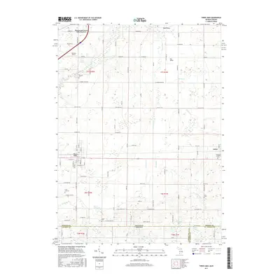
2017 Map of Three Oaks
USGS Topo · Published 2017About this map
The village of Three Oaks and the surrounding Berrien County landscape are defined by the winding course of the Galien River as it makes its way toward Lake Michigan. This modern survey shows a region where rural agriculture meets lakeside communities, including Shorewood-Tower Hills-Harbert and New Troy. Genealogists will find significant detail in the mapping of local burial sites, such as Riverside Cem, Forest Lawn Cem, and Shedd Cem, along with specific family markers like the Germinder and Ward Graves and the Swem Grave near the eastern edge of the quadrangle. The terrain is dotted with small bodies of water like Klutes Lakes, Davidson Lake, and Speer Lake, while Benedick Airport serves as a local aviation landmark. A clear boundary line marks the southern border where Berrien County meets Laporte and St. Joseph Counties at the Michigan Indiana state line.
Find a feature on this map
99 named features on this map. Tap any name to fly to it.
Don’t see what you’re looking for? This feature index may not catch every label — zoom into the map to look around manually.
Map Details
Editions of this 2017 Three Oaks Map
This is the sole edition of this map. No revisions or reprints were ever made.
Other maps of this area

1927 · Niles
USGS Topo · 1:62,500

1930 · Three Oaks
USGS Topo · 1:62,500

1930 · Niles
USGS Topo · 1:62,500

1943 · Niles
USGS Topo · 1:62,500

1944 · Three Oaks
USGS Topo · 1:62,500

1953 · Chicago
USGS Topo · 1:250,000

1957 · Chicago
USGS Topo · 1:250,000

1958 · Lydick
USGS Topo · 1:24,000

1958 · Springville
USGS Topo · 1:24,000

1958 · New Carlisle
USGS Topo · 1:24,000