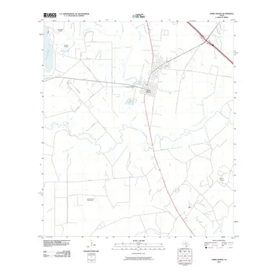
2010 Map of Three Rivers
USGS Topo · Published 2010About this map
The confluence of three major South Texas waterways—the Frio River, the Atascosa River, and the Nueces River—defines this landscape near the settlement of Three Rivers. Just west of the town center, the Three Rivers Dam manages the flow near Sinclair Lake and Yarbrough Lake. This area of Live Oak County shows a complex network of ranch and county roads, including Co Rd 403 and FM 1042, which connect smaller locales like Ike and industrial features such as the Oakville-Wilcox Gas Field. The presence of the Beefmasters Best Airport and several named topographic features like Sinclair Hollow and Live Oak Hollow reflects the regional reliance on aviation and ranching. The map illustrates how human infrastructure, from the grid of Three Rivers to isolated petroleum operations, has integrated into the delta-like environment formed by these converging river systems.
Find a feature on this map
38 named features on this map. Tap any name to fly to it.
Don’t see what you’re looking for? This feature index may not catch every label — zoom into the map to look around manually.
Map Details
Editions of this 2010 Three Rivers Map
This is the sole edition of this map. No revisions or reprints were ever made.
Other maps of this area

1920 · Mikeska
USGS Topo · 1:125,000

1925 · Oakville No. 4
USGS Topo · 1:48,000

1925 · Simmons No. 1
USGS Topo · 1:48,000

1927 · Oakville
USGS Topo · 1:62,500

1929 · Simmons
USGS Topo · 1:62,500

1930 · Whitsett
USGS Topo · 1:62,500

1942 · Whitsett
USGS Topo · 1:62,500

1953 · Crystal City
USGS Topo · 1:250,000

1955 · Crystal City
USGS Topo · 1:250,000

1956 · Suniland
USGS Topo · 1:62,500