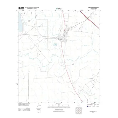
2013 Map of Three Rivers
USGS Topo · Published 2013About this map
The confluence of three major waterways—the Atascosa River, Frio River, and Nueces River—defines the landscape surrounding the town of Three Rivers. This 2013 survey reveals a geography shaped by both natural river courses and industrial energy extraction, most notably at the Oakville-Wilcox Gas Field to the southeast. The town site itself is situated just north of the junction where the Frio and Atascosa meet, with residential streets like Avenida Seguin and Tullos St clustered near the Three Rivers Lake bypass.
Find a feature on this map
58 named features on this map. Tap any name to fly to it.
Don’t see what you’re looking for? This feature index may not catch every label — zoom into the map to look around manually.
Map Details
Editions of this 2013 Three Rivers Map
This is the sole edition of this map. No revisions or reprints were ever made.
Other maps of this area

1920 · Mikeska
USGS Topo · 1:125,000

1925 · Oakville No. 4
USGS Topo · 1:48,000

1925 · Simmons No. 1
USGS Topo · 1:48,000

1927 · Oakville
USGS Topo · 1:62,500

1929 · Simmons
USGS Topo · 1:62,500

1930 · Whitsett
USGS Topo · 1:62,500

1942 · Whitsett
USGS Topo · 1:62,500

1953 · Crystal City
USGS Topo · 1:250,000

1955 · Crystal City
USGS Topo · 1:250,000

1956 · Suniland
USGS Topo · 1:62,500