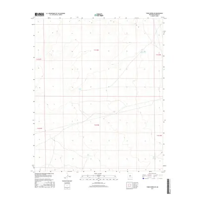
2017 Map of Three Rivers SW
USGS Topo · Published 2017About this map
Water management dominates this arid New Mexico landscape, where a series of tanks and small catchments reveal the essential infrastructure of ranching in Otero County. Features such as Double Mills Reservoir and Lower Steer Pasture Tank highlight the necessity of reliable water sources for livestock across these high desert flats. The terrain is marked by subtle topographic shifts between drainage basins, serving the larger agricultural and ranching operations of the region. Local names like Road Tank, Sand Tank, and Long Tank indicate a history of land use focused on directing seasonal runoff. This survey provides a clear view of the Public Land Survey System boundaries, specifically where t11s r8e meets t12s r8e, tracing the grid that defined settlement and property lines in this part of the Southwest.
Find a feature on this map
11 named features on this map. Tap any name to fly to it.
Don’t see what you’re looking for? This feature index may not catch every label — zoom into the map to look around manually.
Map Details
Editions of this 2017 Three Rivers SW Map
This is the sole edition of this map. No revisions or reprints were ever made.
Other maps of this area

1916 · Tularosa
USGS Topo · 1:125,000

1947 · Three Rivers
USGS Topo · 1:62,500

1947 · Capitol Peak
USGS Topo · 1:62,500

1948 · Lumley Lake
USGS Topo · 1:62,500

1948 · Tularosa
USGS Topo · 1:62,500

1950 · Three Rivers
USGS Topo · 1:24,000

1950 · Oscura
USGS Topo · 1:24,000

1954 · Tularosa
USGS Topo · 1:250,000

1958 · Tularosa
USGS Topo · 1:250,000

1981 · Tularosa
USGS Topo · 1:100,000